IODP计划介绍
IODP 计划的历史
科学钻井船使科学家能够进入地球上一些最具挑战性的环境:海底,并从中收集沉积物、岩石、流体和生物体的数据和样本。长期的海洋科学钻探方面的国际合作改变了人类对地球的理解,解决了有关地球动态历史、过程和结构的基本问题。
作为一种研究技术的海洋科学钻探发展导致了新工具和方法的发展,并促进了研究、教育和公众参与方面的持久国际合作。
?> 1940 年:活塞取芯技术的进步
1940 年代活塞取芯技术的进步使研究船能够定期从海底回收长段沉积物。
这些海底沉积物随着地质时间的推移缓慢积累,包含微观化石,其化学成分代表了古代海洋条件。
活塞取芯被用于探险,例如瑞典研究船信天翁号的全球巡航,以开始研究在世界海洋底部捕获的丰富多样的行星历史。
?> 1961 年:mohole 莫霍计划
1961 年,当动态定位成功地使钻井平台 CUSS 在强流中保持目标时,科学钻井在研究地球海底地质变得可行。

莫霍计划项目 是向美国国家科学基金会提出的一个概念,它考虑了钻探地质边界的可行性,该地质边界由岩石物理参数(Mohorovičić 不连续性)的突然变化确定层。
?> 1966-1983:Deep Sea Drilling Project - 深海钻探项目(DSDP)
海洋科学钻探的下一阶段为深海钻探项目 (DSDP 1966-1983), 1966 年开始使用钻井船 Glomar Challenger (格洛玛挑战者号)。

格洛玛挑战者号开创性地在大西洋、太平洋和印度洋以及地中海和红海进行了钻探和取芯作业,同时推进了深海钻探技术。
?> 1983-2003:Ocean Drilling Program - 海洋钻探计划(ODP)
1985 年,JOIDES 决议在海洋钻探计划 (ODP 1983-2003) 开始时取代格洛玛挑战者号。
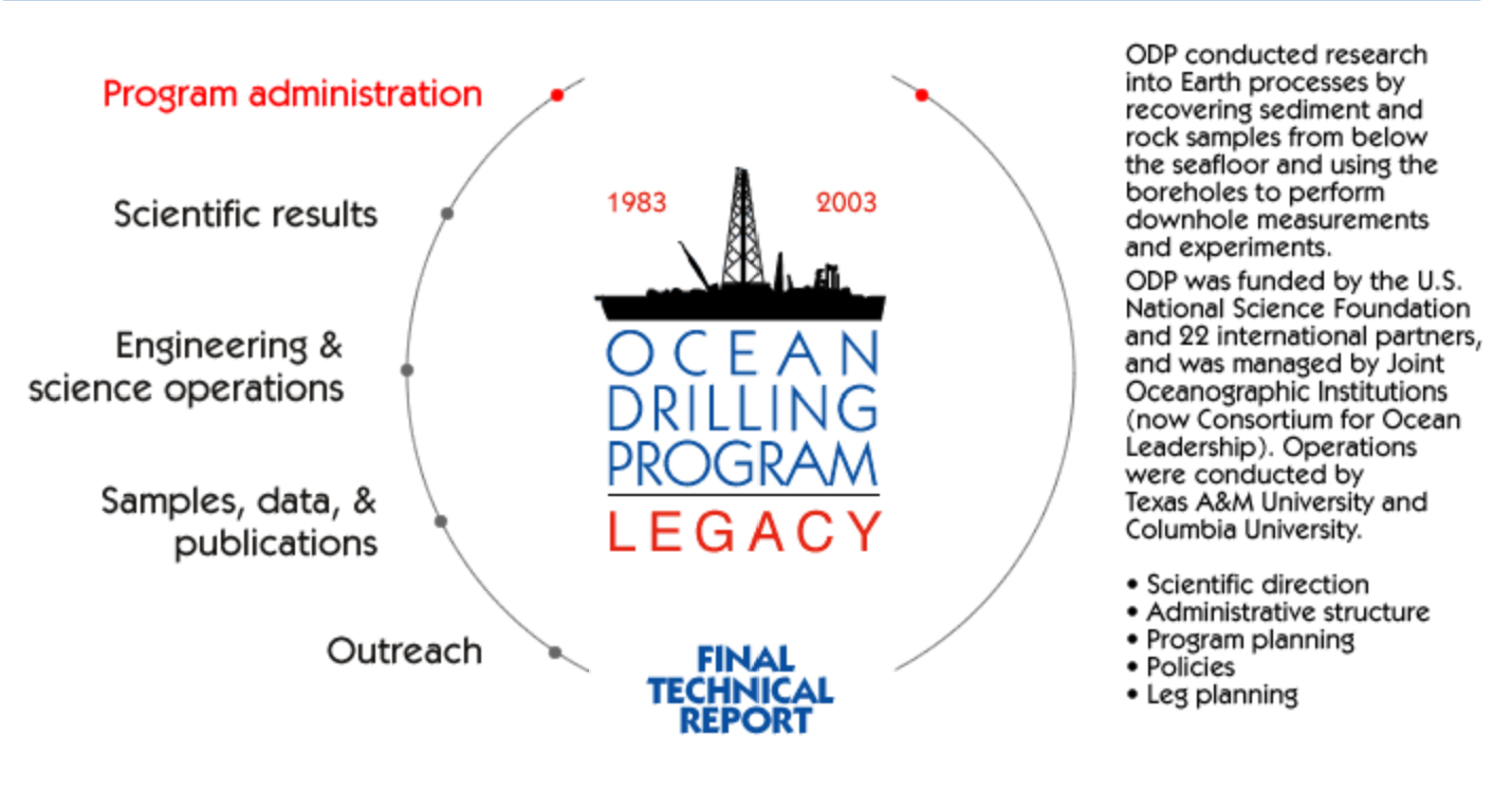
ODP 是一项国际合作努力,旨在探索和研究地球海底的组成和结构。
JOIDES 决议为 ODP 进行了 110 次探险,在位于世界各大洋盆地的 2000 个钻孔中进行了考察。
?> 2003-2013:Integrated Ocean Drilling Program - 综合大洋钻探计划(IODP)
综合海洋钻探计划 (IODP 2003-2013) 建立在 DSDP 和 ODP 的国际伙伴关系和科学成功的基础上,采用了由 26 个参与国出资资助的多个钻探平台。
翻新的 JOIDES Resolution、配备新海洋立管的日本深海钻井船 Chikyu 和专门的特定任务平台在 52 次探险中被用于到达全球地下的新区域。

IODP 2003-2013 保存的文件档案包含来自该计划小组和咨询机构的报告、会议记录和其他文件。
?> 2013 年至今:International Ocean Discovery Program - 国际海洋探索计划 (IODP)
自 2013 年 10 月以来,IODP 合作伙伴通过国际海洋发现计划 (IODP) 继续合作。
国际海洋发现计划 (IODP) 是一项国际海洋研究合作项目,利用远洋研究平台探索地球的历史和动力学,以恢复记录在海底沉积物和岩石中的数据并监测海底环境。
IODP 依赖于由三个平台提供商资助的设施,以及来自另外五个合作伙伴机构的财政捐助。这些实体共同代表了 22 个国家,这些国家的科学家被选为在全球海洋进行的 IODP 研究探险的工作人员。科学家活动由 IODP 计划成员办公室管理。

IODP 探险是根据科学计划“照亮地球的过去、现在和未来”的科学提案开发的,并根据该计划的科学调查原则进行。
该科学计划确定了气候变化、深层生命、行星动力学和地质灾害四个领域的 14 个挑战问题。
IODP 的科学调查原理
国际海洋发现计划 (IODP) 是一项国际研究合作,旨在解决地球、海洋、环境和生命科学领域的重要问题,其基础是通过专业的远洋钻探和研究平台分析钻芯、钻孔成像、天文台数据以及使用从海底下获得的相关地球物理成像相关数据。
IODP 合作在谅解备忘录中得到进一步阐述,在平台提供者和帮助资助研究平台的国家之间建立伙伴关系。
IODP 调查基于解决计划指导文件“照亮地球的过去、现在和未来”的 IODP 科学计划或其他杰出的新研究想法中描述的目标的研究提案。
IODP 提案由国际代表组成的顾问小组审查。这些小组就科学质量、可行性、安全和环境问题向 IODP 平台运营商提供独立建议。 IODP 的科学海洋钻探提案,包括研讨会提案,均以公平、公正的方式进行评估,以避免利益冲突。顾问小组由 JOIDES 决议设施委员会监督,但为所有 IODP 钻探和研究平台提供服务。
考察安排的决定由提供 IODP 钻井平台运营和管理监督的设施委员会(JOIDES 决议设施委员会、Chikyu IODP 委员会和 ECORD 设施委员会)做出。每个设施委员会都是其监督的钻井和研究平台的决策机构,而该平台从事 IODP 探险。设施委员会在可行的情况下并在资源可用性的限制内努力实现通用的 IODP 程序和政策。
提交给该计划的任何科学提案的知识产权都属于提案作者(提案人),直到提案被安排作为 IODP 探险的一部分进行钻探。那时,该计划获得了发布提案和开展科学研究的权利。该计划将尽一切努力来认可支持者的智力努力。
IODP 探险将由平台运营商根据资助研究平台的参与国之间的谅解备忘录选出的国际科学家团队进行。人员配备决定将尽可能考虑原始支持者的智力贡献以及在科学党内实现多样性的目标。
IODP 探险旨在对环境没有重大影响,并按照 IODP 环境原则中进一步解释的最高可接受的环境敏感性水平进行。
IODP 的政策、程序、建议和会议记录在该计划的提案、样本和数据保密政策范围内向公众公开。
一旦探险科学组的成员有合理的机会在既定的暂停期限(通常为一年)内完成他们的初步研究,IODP 将提供对所有探险样本和数据的公开访问。
数据暂停期满后,该计划将公布所有发现、岩心和钻孔细节、探险期间获得的数据的详细说明,并将所有样本和岩心(工作半部)提供给任何具有良好科学依据的科学家。根据 IODP 样本、数据和义务政策进行拟议科学的提案和经过验证的设施。
部分航次
| Leg | Description | 简单翻译 | Objective |
|---|---|---|---|
| 100 | Gulf of Mexico | 墨西哥湾 | Shakedown Cruise. |
| 101 | Bahamas Carbonate Platforms | 巴哈马碳酸盐平台 | Determination of development of the Bahamas carbonate platform. |
| 102 | Western Atlantic | 西大西洋 | To conduct logging and geophysical experiments to determine in-situ geophysical behavior of old oceanic basement. |
| 103 | Galicia Bank | 加利西亚银行 | To elucidate the history of rifting, subsidence, and sedimentation on the Galacia margin and the beginning of seafloor spreading. |
| 104 | Norwegian Sea | 挪威海 | To study age and nature of dipping reflectors and underlying basement, history of passive margin, paleoceanographic, paleoclimatic, and evolution of flora and fauna of the Norwegian-Greenland Sea. |
| 105 | Labrador Sea / Baffin Bay | 拉布拉多海 / 巴芬湾 | To study the early tectonic and paleoceanographic history of the North Atlantic and its connection to the Arctic Ocean through time. |
| 106 | Mid-Atlantic Sea | 大西洋中部 | Dedicated to establishing the first hole in zero-age crust in a well-studied portion of the Mid-Atlantic Ridge rift valley, south of the Kane fracture Zone. (With Leg 109) |
| 107 | Tyrrhenian Sea | 第勒尼安海 | To determine the timing and rate of extension and subsidence during the stretching phase as well as during the stage of oceanic crust emplacement. |
| 108 | Northwest Africa | 西北非洲 | For high resolution paleoclimatic studies of Neogene sediments. |
| 109 | Mid-Atlantic Ridge | 大西洋中部岭 | Dedicated to establishing the first hole in zero-age crust in a well-studied portion of the Mid-Atlantic Ridge rift valley, south of the Kane fracture Zone. (With Leg 106) |
| 110 | Lesser Antilles | 小安的列斯群岛 | To investigate geologic and hydrologic problems along the northern Barbados Ridge by penetrating the accretionary prism, the decollement and underthrust sediment to the oceanic crust. |
| 111 | Panama Basin (Hole 504B) | 巴拿马盆地(孔 504B) | To deepen and log Hole 504B; focus on coring and logging the sheeted dike complex. |
| 112 | Peru Margin | 秘鲁保证金 | Discovering the amplitude and timing of vertical tectonic movement of the Andean Continental Margin, and to date the onset and determine the response of the coastal upwelling circulation regime to tectonic and climatic forcing. |
| 113 | Weddell Sea | 韦德尔海 | To address the formation and history of the Antarctic ice-sheets, Antarctic bottom water, oceanic planktonic production, and evolution of the Antarctic planktonic and benthic biota in the Weddell Sea. |
| 114 | Subantarctic South Atlantic | 南大西洋亚细安 | To document the climatic, glacial, and oceanographic history of the region within the context of a more complete and detailed geochronologic framework than previously available. |
| 115 | Mascarene Plateau | 马斯卡琳高原 | To examine paleoceanograpy and stratigraphy in the tropical Indian Ocean and hotspot volcanism of the elevated plateaus and ridges scattered throughout the basin. |
| 116 | Bengal Fan | 孟加拉风扇 | To determine onset and history of intraplate deformation, to characterize the lithofacies, diagenesis, and provenance of the Bengal Fan. |
| 117 | Oman Margin | 阿曼保证金 | To explore the origin, evolution, and variablitiy of the Indian Ocean Monsoon and its effect on the oceanic environments of the western Arabian Sea and the paleoclimates of tropical Africa, Arabia, India and Asia. |
| 118 | Southwest Indian Ridge | 西南印度岭 | To drill a deep hole in upper mantle peridotite with the aid of a hard rock guidebase and to conduct geophysical logging and other downhole measurements. |
| 119 | Prydz Bay | 普瑞兹湾 | A transect, along with Leg 120, to study the Late Cretaceous to Holocene paleoclimatic history of East Antarctic, tectonic history of the Kerguelen Plateau, and the late Mesozoic rifting history of the Indian plate from Easr Antarctica. |
| 120 | South Kerguelen | 南克格伦 | A transect, along with Leg 119, to study the Late Cretaceous to Holocene paleoclimatic history of East Antarctic, tectonic history of the Kerguelen Plateau, and the late Mesozoic rifting history of the Indian plate from East Antarctica. |
| 121 | Broken Ridge | 破碎的山脊 | To ascertain the age, lithology, and depositional depth of sediments at Broken Ridge, and to determine pre-, syn-, and post-rift deposits. |
| 122 | Exmouth Plateau | 埃克茅斯高原 | To understand the Triassic-Jurassic rift history, the Cretaceous to Cenozoic post-breakup sedimentation and paleoenvironment and depositional sequences of the Exmouth Plateau. |
| 123 | Argo Abyssal Plain | 阿戈深渊平原 | To address the final stages of rifting and the formation of volcanic basement and early oceanic sediments in the Argo and Gascoyne Abyssal plains. |
| 124 | SE Asia Basins, Luzon Strait | 东南亚盆地,吕宋海峡 | To focus on the age, stratigraphy, paleoceanography, and stress of the rocks in the Sulu and Celebes Seas. 124E - Dedicated to engineering development including Diamond Coring System (DCS), Navidrill (NCB), and Pressure Core Sampler (PCS). |
| 125 | Bon Mar I | 好海 I | To investigate the chemistry, timing and mechanism of emplacement of serpentinite seamounts and the tectonic history of the Izu-Bonin forearc. |
| 126 | Bon Mar II | 邦马二世 | To determine differental uplift/subsidence, the nature of volcanism, and chemistry of the arc-background and uplift/subsidence, stratigraphy and chemistry of sedimentation, and nature of basement in the forearc region of Izu-Bonin Arc. |
| 127 | Japan Sea I | 日本海 I 号 | To access the style and dynamics rifting of basement, to characterize the sedimentation and evolution, the age and history and magnitude and direction of the present stress field in the region. |
| 128 | Japan Sea II | 日本海 II | To obtain a master Miocene to Holocene paleoceanographic section, detail of the depositional history of a failed back-arc rift and to conduct downhole multiship geophysical experiments. |
| 129 | Old Pacific Crust | 旧太平洋地壳 | To recover Jurassic sediment and oceanic crust that might be the oldest in the Pacific Ocean and possibly in the world oceans. |
| 130 | Ontong Java Plateau | 通川高原 | Recover a complete record of Neogene, Paleogene, and Late Cretaceous history, with the goal of achieving a detailed reconstruction of paleoceanography and paleoclimate. |
| 131 | Nankai Trough | 南开沟 | Elucidation of the influence of pore fluid of accretionary prism, mechanical state of deformed sediments, and the fabrics and structural styles of sediments before and after accretion. |
| 132 | West-Central Pacific | 中太平洋西部 | To study the influence of pore fluid and hydrogeology of the accretionary prism, the mechanical state, fabrics and structural styles of sediments before and after accretion. |
| 133 | Northeast Australia | 澳大利亚东北部 | To define the sedimentary response to global changes in sea level in the late Cenozoic and Quaternary, and to define the influence of paleochemistry, paleoclimate, and paleoceanography on carbonate platforms. |
| 134 | Vanuatu | 瓦努阿图 | To study processes involved in the evolution of a island arc within the zone of influence of arc-ridge collision |
| 135 | Lau Basin | 刘盆地 | To assess the nature and geologic history of the oceanic crust in the Lau Basin and Tonga Platform and to understand the processes that formed the island-arc systems on its east and west boundaries. |
| 136 | OSN-1 | OSN-1 | To prepare a seafloor site for future experiments needed to develop the Ocean Seismographic Network (OSN). |
| 137 | Panama Basin (Hole 504B) | 巴拿马盆地(孔 504B) | To revisit Hole 504B in the eastern equatorial Pacific to recondition the hole for future ODP operations. |
| 138 | East Equatorial Pacific | 东赤道太平洋 | Recover complete, high resolution paleoclimatic records of the eastern equatorial Pacific Ocean. |
| 139 | Sedimented Ridges | 沉积的山脊 | To characterize the hydrothermal discharge and mineralization in the Juan de Fuca Ridge rift on a regional scale. |
| 140 | Panama Basin (Hole 504B) | 巴拿马盆地(孔 504B) | The primary objective was to revisit Hole 504B in the eastern equatorial Pacific to deepen it into the sheeted dike complex toward and through the dike/gabbro and/or seismic Layer 2/3 transitions. |
| 141 | Chile Triple Junction | 智利三重交汇点 | Focused on the effects of spreading-ridge subduction, the timing, rate, amplitude of vertical motion in the forearc, the seaward limit of continental crust, and the nature, petrology and chemical affinities of near trench volcanism. |
| 142 | East Pacific Rise | 东太平洋崛起 | To continue testing and development of engineering equipment as well as to provide scientific results from the East Pacific Rise. |
| 143 | Atolls and Guyots I | 环礁和古约茨一 | To address a number of problems concerning guyot development including: timing and causes of platform drowning, timing and amplitude of sea level changes, and seamount latitude changes. |
| 144 | Atolls and Guyots II | 环礁和古约茨二世 | To address a number of problems concerning guyot development including: timing and causes of platform drowning, timing and amplitude of sea level changes, and seamount latitude changes. |
| 145 | North Pacific Transect | 北太平洋跨区 | To enhance understanding of the paleoceanography and paleoclimatology of the North Pacific Ocean. |
| 146 | Cascadia | 卡斯卡迪亚 | To evaluate the role of fluid flow in the structural development of the Cascadia accretionary wedge and to determine how that flow controls the composition, distribution, concentration and flux of biogeochemical species. |
| 147 | Hess Deep | 赫斯深 | To address questions concerning crustal and upper mantle processes. |
| 148 | Panama Basin (Hole 504B) | 巴拿马盆地(孔 504B) | To deepen Hole 504B with the main goals of penetrating into oceanic Layer 3 and determining the nature of the transition from Layer 2 to Layer 3. |
| 149 | Iberian Abyssal Plain | 伊比利亚深渊平原 | The principal objective of Leg 149 was to sample the upper crust within the OCT of the Iberian Abyssal Plain to establish its nature and to test some of the predictions based on geophysical observations. |
| 150 | New Jersey Sea Level Transect | 新泽西州海平面横贯 | Address sea-level history recorded in siliciclastic sequences from a passive margin. |
| 151 | North Atlantic Gateways I | 北大西洋门户一 | Describe basic physiography, plate tectonic, and volcanic history of the modern deep sea basin and evaluate the paleoceanographic and paleoenvironmental changes of these water masses. |
| 152 | Eastern Greenland Margin | 格陵兰岛东部边缘 | To establish the development of volcanism with time and provide a spatial image of volcanism. |
| 153 | Mid Atlantic Ridge, Kane Transform(MARK) | 大西洋中部岭,凯恩转换(马克) | The investigation of the mantle flow and partial melting history of the ultramafic rocks, the crystallization of the gabbros and the deformation and metamorphism attending seafloor spreading in this environment. |
| 154 | Ceara Rise | 塞拉上升 | Recover sediments from a series of sites on the slope of Ceara Rise to develop a depth transect of samples for paleoceanographic reconstructions. |
| 155 | Amazon Fan | 亚马逊风扇 | To investigate the Amazon Fan, a large, muddy fan and the climatic records that it contains. |
| 156 | North Barbados Ridge | 北巴巴多斯岭 | To evaluate the role of faults in fluid transport and the episodicity of fluid flow and its relationship to seismicity. |
| 157 | Gran Canaria and Madeira Abyssal Plain | 大加那利岛和马德拉深渊平原 | Determine the Neogene erosional history of the Canary basin and to provide insights into the links between mass sediment wasting on continental margins and climate/sea level change. |
| 158 | TAG Active Hydrothermal Mound | 标签活动热液土堆 | Investigate fluid flow, alteration and mineralization and associated geochemical fluxes, microbiological processes, and the subsurfaces nature of an active hydrothermal system on a slow spreading, sediment-free mid-ocean ridge. |
| 159 | Cote d'Ivoire-Ghana Transform Margin | 科特迪瓦-加纳转换边际 | To better understand the evolution of transform continental margins and to document changes in deep and intermediate waters passing through the eastern equatorial Atlantic. |
| 160 | Mediterranean Sea I | 地中海 I | Investigate the tectonic and paleoceanographic history of the Mediterranean Sea. |
| 161 | Mediterranean Sea II | 地中海 II | Investigate the accretionary and collisional processes associated with the convergent boundary between the African and Eurasian plates. Sample western part of basin for westernmost occurrence of sapropels. |
| 162 | North Atlantic Gateways II | 北大西洋门户 II | Recover sedimentary sequences in order to investigate the evolution of Northern Hemisphere climate on time scales ranging from hundreds to millions of years. |
| 163 | Southeast Greenland Margin | 格陵兰岛东南部边缘 | Investigate the nature of rifting and breakup of the Southeast Greenland rifted continental margin. Assess the impact of the Iceland mantle plume on breakup and early seafloor spreading. |
| 164 | Blake Ridge and Carolina Rise | 布莱克里奇和卡罗来纳上升 | Investigate the in situ characteristics and amounts of natural gas hydrate stored in sediments. |
| 165 | Caribbean Ocean History | 加勒比海洋历史 | Investigate the nature of the Cretaceous/Tertiary Boundary and the influence of tropical seas on global ocean history and climate evolution; investigate early formation of the Caribbean Plate. |
| 166 | Bahamas Transect | 巴哈马转学 | To address causes and effects of eustatic sea-level fluctuations and fluid flow processes in the margins of carbonate platforms. |
| 167 | California Margin | 加州保证金 | Study the links between the evolution of North Pacific climate and the development of the California Current System and the climate links between the North Pacific and North America. |
| 168 | East Flank of the Juan de Fuca Ridge | 胡安德富卡岭东侧 | Focused on exploring the causes and consequences of ridge-flank hydrothermal circulation through observations of lateral gradients of temperature, pressure, fluid composition, and rock alteration. |
| 169 | Sedimented Ridges II, Saanich Inlet | 沉积岭 II,萨尼奇入口 | Investigation of the mechanisms of formation of massive sulfide deposits at sedimented ridges, history and diagenesis at sedimented rifts. MIDDLE VALLEY-Measure temperature gradient and sample hydrothermal, reinstrument and reseal CORK. |
| 170 | Costa Rica Accretionary Wedge | 哥斯达黎加行政楔子 | Determine mass- and fluid-flow paths through a constrained accretionary complex, to calculate mass and fluid balances, to understand these processes using structural data, physical and chemical properties of the sediments and pore fluids. |
| 171 | Blake Nose Paleoceanographic Transect | 布莱克鼻子古海洋学转世 | A - Determine the sediment, chemical, and fluid mass balances in the Barbados prism. B - Interpret the vertical structure, thermocline and water structure, climate variability, and to recover K/T and P/E boundaries, of the Blake Plateau. |
| 172 | Northwest Atlantic Sediment Drifts | 西北大西洋沉积物漂移 | To obtain a history of late Neogene paleoceanography and paleoclimate in the North Atlantic, millennial scale oscillations, the cyclicity of these oscillations and how these cycles relate to the history of Northern Hemisphere glaciation. |
| 173 | Return to Iberia | 返回伊比利亚 | To study the nature of the basement of the Ocean-Continent Transition, to relate it to the problems of modes of lithospheric extension and rift-to-drift processes, and to test aspects of the models for these tectonic and igneous processes. |
| 174 | New Jersey Mid-Atlantic Transect | 新泽西州中大西洋跨 | A - To investigate the stratigraphic responses to sea-level change, to date boundaries of Oligocene to Holocene, to place constraints on the sea-level change, and to provide a baseline for future drilling. B - To log and CORK hole 395A. |
| 175 | Benguela Current | 本格拉电流 | To focus primarily on the paleoceanographic and paleoclimatic aspects of the Benguela Current upwelling system and the upwelling area off Angola and Namibia with regard to early diagenetic processes taking place in this unique environment. |
| 176 | Southwest Indian Ridge (Hole 735B) | 印度西南部山脊(洞 735B) | Obtain a section of layer 3 gabbros to document magmatic, hydrothermal, and tectonic processes in the lower ocean crust and to determine if the boundary between igneous crust and the depleted mantle lies above the Mohorovicic discontinuity. |
| 177 | Southern Ocean Paleoceanography | 南大洋古海洋学 | To augment the biostratigraphic, biogeographic, paleoceanographic, and paleoclimatic history of the Southern Ocean during the Cenozoic, and to understand the role of the Southern Ocean in climate change in the Quaternary and late Neogene. |
| 178 | Antarctic Glacial History and Sea-Level | 南极冰川历史与海平面 | To extract the past 10 Ma of continental glaciation contained in the Antarctic Peninsula Pacific margin, compile an optimal history of grounded ice-volume fluctuation, and assess the main controls on sediment transport and deposition. |
| 179 | Hammer Drilling and NERO | 锤子钻探和尼禄 | Determine the operational characteristics of the hammer drill, determine the viability of the hammer drill-in casing system, and to determine the maximum allowable slope for hammer drill operations. |
| 180 | Western Woodlark Basin, Papua New Guinea | 西伍德拉克盆地,巴布亚新几内亚 | Characterize the composition and in situ properties (stress, temperature, physical properties, and fluid pressure) of an active low-angle normal-fault zone, and determine the vertical motion history of both the hanging wall and footwall. |
| 181 | Southwest Pacific Gateways | 西南太平洋网关 | Delineate the Cenozoic development of zonal water masses, the changing paleohydrography, the history of productivity and surface water mass fluctuations, and test the record of circum-Antarctic flow against the Milankovitch orbital model. |
| 182 | Great Australian Bight | 伟大的澳大利亚贝特 | The paleoceanographic history of a carbonate-dominated, mid-latitude continental margin and adjacent basin during evolution of the Southern Ocean, the formulation of models, and determination of the Southern Ocean basin sea-level record. |
| 183 | Kerguelen Plateau-Broken Ridge | 克格伦高原断裂岭 | Determine the chronology of Kerguelen/Broken Ridge magmatism, mineralogy and composition of mantle sources, melting processes, and magmatic evolution, evaluate the effects of LIP formation on the environment. |
| 184 | South China Sea | 南海 | The long-term goals of Leg 184 are to determine the evolution and variability of the East Asian monsoon during the late Cenozoic and to improve our knowledge of the links between climate and tectonics. |
| 185 | Izu-Mariana Margin | 伊豆-马里亚纳保证金 | To sample the upper oxidative zone of alteration of this oldest in situ oceanic crust (Hole 801C) and to provide the first complete section of sediment and a significant section of altered oceanic crust that enters this subduction zone. |
| 186 | Western Pacific Geophysical Observatory | 西太平洋地球物理观测站 | Installation of a long-term geophysical observatory of the highest achievable sensitivity, Miocene and Younger Volcanic Ash Stratigraphy in the Western Pacific and subsidence History across the Continental Slope and Nature of the K Basement |
| 187 | Australian-Antarctic Rifting | 澳大利亚-南极裂谷 | The primary objective will be to locate the Indian/Pacific isotopic boundary and determine its configuration by investigating strongly interrelated geochemical, geophysical, and microbiological categories for discussion. |
| 188 | Prydz Bay - Cooperation Sea, Antarctica | 普瑞兹湾 - 合作海,南极洲 | Date glacial activity in Prydz Bay and the Paleogene environment of Antarctica, link events in the East Antarctic Ice Sheet with changes in the Southern Ocean, acquire a record of ice advances to the shelf edge and interglacial deposits. |
| 189 | Tasmanian Gateway: Cenozoic climate | 塔斯马尼亚门户:生化气候 | Provide data about the Indian Ocean and South Pacific paleoenvironments prior to opening (mid to late Eocene) of the Tasmanian Seaway, address the shallow-water (late Eocene) and deep-water breakthrough breakthroughs (Oligocene?) |
| 190 | Nankai Trough Accretionary Prism I | 南开槽累积棱镜一 | To sample the decollement zone at critical points beneath the Nankai prism and PTZ to document the spatial variations in structure and fluid pressure to test these hypotheses of decollement formation and evolution. |
| 191 | NW Pacific Seismic Observatory | 西北太平洋地震观测站 | Installation of a seismic observatory of the Global Seismic Network to study earth structure and upper mantle dynamics; paleomagnetic, geochemical and isotopic analyses of MORB basalts; to examine the Pacific lithosphere for microorganisms. |
| 192 | Basement Drilling of Ontong Java Plateau | 通川高原地下钻探 | To determine age and duration of emplacement of the Ontag Java Plateau, the range and diversity of magmatism, the environment and style of eruption, formation and fundamental processes governing the crustal development of oceanic plateaus |
| 193 | Hydrothermal System, Eastern Manus Basin | 热液系统,东马努斯盆地 | To delineate the subsurface volcanic architecture, the structural and hydrologic characteristics, and the deep-seated mineralization and alteration patterns of the PACMANUS hydrothermal field. |
| 194 | Marion Plateau | 马里恩高原 | To investigate paleoceanographic variations in the western Coral Sea, to correlate these variations with changes in sea level, and to determine the absolute magnitude of the major Cenozoic sea-level falls. |
| 195 | Seafloor Observatories, Kuroshio Current | 海底观测站,库罗西奥电流 | Set a long-term observatory at the summit of South Chamorro Seamount, and installation of a broadband seismometer for a long-term subseafloor borehole observatory in the Philippine Sea abyssal seafloor. |
| 196 | Nankai Trough Accretionary Prism II | 南开沟累积棱镜 II | Conduct logging-while-drilling (LWD) activities at three sites previously cored on the Muroto Transect during Legs 131 and 190, Sites 808 and 1173 will be sealed with multipacker advanced circulation obviation retrofit kits (ACORKs). |
| 197 | Motion of the Hawaiian Hotspot | 夏威夷热点运动 | To obtain cores from lava flows suitable for paleomagnetic, paleolatitude, and radiometric age determinations, and to determine the geochemical variation of the volcanic products of the Hawaiian hotspot through time. |
| 198 | Shatsky Rise | 沙茨基崛起 | To address the long-term climatic transition into and out of "greenhouse" climate and abrupt climatic events; to characterize changes in surface and deep waters, including vertical gradients of temperature, oxygenation, and corrosiveness. |
| 199 | Paleogene Pacific | 古生物太平洋 | To study the evolution of the equatorial Pacific current, provide continuous records of sea surface and abyssal temperatures, stability of the water column, heat transfer out of the tropics, ocean circulation, and trade wind belts and ITCZ. |
| 200 | Hawaii-2 Observatory, Nuuanu Landslide | 夏威夷-2 天文台,努阿努滑坡 | To drill one hole near the Hawaii-2 Observatory junction box to install a high-quality broadband three-component borehole seismometer (0.001-5.0 Hz) connected to the Hawaii-2 cable for power supply and continuous real-time telemetry. |
| 201 | Peru Biosphere | 秘鲁生物圈 | To explore the distribution, activities, community structure, phylogenetic affinities, and global biogeochemical consequences of microbial communities buried in deep-sea sediments including the Peru coastal margin and Peru Basin. |
| 202 | Southeast Pacific Paleoceanography | 东南太平洋古海洋学 | The objectives are paleoceanographic: to assess climate and oceanographic changes in the southeast Pacific over Neogene time, to probe the climate system at three different but compatible scales: tectonic, orbital, and millennial. |
| 203 | Equatorial Pacific ION | 赤道太平洋离子 | To drill one hole in the western equatorial Pacific, to case and grout to the basement and sediments for a future (DEOS) multidisciplinary observatory. This project primarily represents the interests of the DEOS program and ION. |
| 204 | Gas Hydrates | 气体水合物 | Compare the source region for gas and hydrate formation, calibrate estimates of hydrate and gas, test reflectivity variation in seismics, evaluate the relationship between hydrates, fluid flow, and slope stability and bacteria in sediments. |
| 205 | Costa Rica | 哥斯达黎加 | The igneous and alteration history of the basement on the incoming plate. Characterizing and monitoring the three hydrological systems: in basement, in the uppermost section of the subducting sediment, and the decollement and upper conduit. |
| 206 | Fast Spreading Crust | 快速蔓延的结壳 | Characterize the nature of magmatic accretion and the primary and secondary chemical composition, as well as the tectonic and seismic structure of the uppermost oceanic crust, establish a cased reentry hole that is open for future drilling. |
| 207 | Demerara Rise | 德梅拉崛起 | To fill gaps in understanding wholesale extinctions linked to massive perturbations of the global carbon cycle and changes in the Earth's climate from the Cretaceous and Paleogene (oceanic anoxic events and Late Paleocene Thermal Maximum). |
| 208 | Walvis Ridge | 沃尔维斯岭 | Provide a detailed history of paleoceanographic variations and characterization of depth-dependent changes in deepwater chemistry and circulation associated with episodes of early Cenozoic climate change including EECO, PETM, and EOGM. |
| 209 | MAR Peridotite | 马佩里多蒂特 | Characterize spatial variation of mantle deformation patterns, peridotite composition, melt migration features, and hydrothermal alteration along MAR axis. |
| 210 | Newfoundland-Iberia Conjugate Margin | 纽芬兰-伊比利亚结合边缘 | Document rifting of non-volcanic margins, including mantle unroofing, decompression melting, the origin of the deep and crustal asymmetry between conjugates, age-subsidence and strain-partitioning history, and the stratigraphic record. |
| 301 | Juan de Fuca | 胡安·德富卡 | Evaluate hydrogeologic properties, of oceanic crust; determine fluid path distribution in a hydrothermal system; relations between fluid circulation, stratigraphy, alteration, microbiology, and seismic properties. |
| 302 | Arctic Coring Expedition - ACEX | 北极科林探险 - ACEX | Paleoceanographic and tectonic evolution of Central Arctic Ocean |
| 303 | North Atlantic Climate 1 | 北大西洋气候 1 | Study strategic sites that record components of North Atlantic Pliocene?Quaternary climate, including the composition and structure of surface or bottom waters and detrital-layer stratigraphy indicative of ice sheet instability. |
| 304 | Oceanic Core Complex 1 | 海洋核心综合体 1 | Investigate the processes that control oceanic core complex formation and the exposure of ultramafic rocks in young oceanic lithosphere. |
| 305 | Oceanic Core Complex 2 | 海洋核心综合体 2 | Investigate the processes that control oceanic core complex formation and the exposure of ultramafic rocks in young oceanic lithosphere. |
| 306 | North Atlantic Climate 2 | 北大西洋气候 2 | Place late Neogene?Quaternary climate proxies in the North Atlantic into a chronology based on a combination of geomagnetic paleointensity, stable isotope, and detrital layer stratigraphies. |
| 307 | Modern Carbonate Mounds. | 现代碳酸盐土堆。 | To recover sediment to groundtruth the origin and evolution of the coldwater coral mounds in Porcupine Seabight. To evaluate sedimentary processes and paleoceanographic history. |
| 308 | Gulf of Mexico Hydrogeology Overpressure and fluid flow on the Gulf of Mexico continental slope. | 墨西哥湾水文地质超压和流体流动在墨西哥湾大陆斜坡上。 | Study of overpressure and fluid flow on the Gulf of Mexico continental slope. |
| 309 | Superfast Spreading 1 | 超高速传播 1 | To drill a complete section of the upper oceanic crust from the extrusive lavas, through the dikes, and into the underlying gabbros. |
| 311 | Cascadia | 卡斯卡迪亚 | To study the occurrences and formation of gas hydrate in accretionary complexes. In addition to the transect sites, a fifth site was established at a cold vent with active fluid and gas flow. |
| 312 | Superfast Spreading 2 | 超高速传播 2 | To drill a complete section of the upper oceanic crust from the extrusive lavas, through the dikes, and into the underlying gabbros. |
| 301 | Juan de Fuca Hydrogeology | 胡安·德·富卡水文地质学 | |
| 302 | Arctic Coring Expedition (ACEX) | 北极科林探险(ACEX) | |
| 303 | North Atlantic Climate 1 | 北大西洋气候 1 | |
| 304 | Oceanic Core Complex Formation, Atlantis Massif 1 | 海洋核心复合地层,亚特兰蒂斯马西夫 1 号 | |
| 305 | Oceanic Core Complex Formation, Atlantis Massif 2 | 海洋核心复合地层,亚特兰蒂斯马西夫 2 | |
| 306 | North Atlantic Climate 2 | 北大西洋气候 2 | |
| 307 | Porcupine Basin Carbonate Mounds | 豪猪盆地碳酸盐土堆 | |
| 308 | Gulf of Mexico Hydrogeology | 墨西哥湾水文地质学 | |
| 309 | Superfast Spreading Rate Crust 2 | 超快速传播率壳 2 | |
| 310 | Tahiti Sea Level | 塔希提海平面 | |
| 311 | Cascadia Margin Gas Hydrates | 卡斯卡迪亚边缘气体水合物 | |
| 312 | Superfast Spreading Rate Crust 3 | 超高速传播率壳 3 | |
| 313 | New Jersey Shallow Shelf | 新泽西浅架 | |
| 314 | NanTroSEIZE Stage 1: LWD Transect | 南特罗西泽阶段 1: Lwd 转录 | |
| 315 | NanTroSEIZE Stage 1: Megasplay Riser Pilot | 南特罗西德阶段 1: 巨型游戏上升器飞行员 | |
| 316 | NanTroSEIZE Stage 1: Shallow Megasplay and Frontal Thrusts | 南特罗西泽阶段 1: 浅巨型播放和正面推力 | |
| 317 | Canterbury Basin Sea Level | 坎特伯雷盆地海平面 | |
| 318 | Wilkes Land Glacial History | 威尔克斯土地冰川历史 | |
| 319 | NanTroSEIZE Stage 2: Riser/Riserless Observatory 1 | 南特罗西德第 2 阶段:上升器/无上升天文台 1 | |
| 320 | Pacific Equatorial Age Transect I | 太平洋赤道时代跨区 I | |
| 321 | Pacific Equatorial Age Transect II / Juan de Fuca | 太平洋赤道时代横断续续 II / 胡安·德富卡 | |
| 322 | NanTroSEIZE Stage 2: Subduction Input | 南导阶段 2: 俯冲输入 | |
| 323 | Bering Sea Paleoceanography | 白令海古海洋学 | |
| 324 | Shatsky Rise Formation | 沙茨基上升形成 | |
| 325 | Great Barrier Reef Environmental Changes | 大堡礁环境变化 | |
| 326 | NanTroSEIZE Stage 3: Plate Boundary Deep Riser 1 | 南特罗西德阶段 3: 板块边界深上升器 1 | |
| 327 | Juan de Fuca Hydrogeology | 胡安·德·富卡水文地质学 | |
| 328 | Cascadia ACORK Observatory | 卡斯卡迪亚阿科克天文台 | |
| 329 | South Pacific Gyre Subseafloor Life | 南太平洋吉尔海底生活 | |
| 330 | Louisville Seamount Trail | 路易斯维尔海山小径 | |
| 331 | Deep Hot Biosphere | 深热生物圈 | |
| 332 | NanTroSEIZE Stage 2: Riserless Observatory | 南特罗西泽第 2 阶段: 无上升天文台 | |
| 333 | NanTroSEIZE Stage 2: Subduction Inputs 2 and Heat Flow | 南特罗西德阶段 2: 俯冲输入 2 和热流 | |
| 334 | Costa Rica Seismogenesis Project (CRISP) | 哥斯达黎加地震生成项目 | |
| 335 | Superfast Spreading Rate Crust 4 | 超高速传播率壳 4 | |
| 336 | Mid-Atlantic Ridge Microbiology | 大西洋中部岭微生物学 | |
| 337 | Deep Coalbed Biosphere off Shimokita | 石木田外的深煤层生物圈 | |
| 338 | NanTroSEIZE Stage 3 - Plate Boundary Deep Riser — 2 | 南特罗西泽阶段 3 - 板块边界深上升 - 2 | |
| 339 | Mediterranean Outflow | 地中海外流 | |
| 340 | Lesser Antilles Volcanism and Landslides | 较小的安的列斯火山和滑坡 | |
| 340T | Atlantis Massif Oceanic Core Complex | 亚特兰蒂斯马西夫海洋核心综合体 | |
| 341 | Southern Alaska Margin Tectonics, Climate & Sedimentation | 阿拉斯加南部边缘构造、气候和沉积 | |
| 341S | SCIMPI | 西皮 | |
| 342 | Paleogene Newfoundland Sediment Drifts | 古生纽芬兰沉积物漂移 | |
| 343 | Japan Trench Fast Drilling Project | 日本海沟快速钻探项目 | |
| 343T | Japan Trench Fast Drilling Project II | 日本海沟快速钻探项目二 | |
| 344 | Costa Rica Seismogenesis Project A Stage 2 (CRISP-A2) | 哥斯达黎加地震生成项目第二阶段(CRISP-A2) | |
| 345 | Hess Deep Plutonic Crust | 赫斯深冥王星壳 | |
| 346 | Asian Monsoon | 亚洲季风 | |
| 347 | Baltic Sea Paleoenvironment | 波罗的海古环境 | |
| 348 | Nankai Trough Seismogenic Zone Experiment Stage 3, Plate Boundary Deep Riser | 南开槽地震区实验阶段 3,板块边界深上升器 |
常用缩略语
| 首字母 | 对应英语 | 翻译 : |
|---|---|---|
| ACORK | Advanced Circulation Obviation Retrofit Kit | 高级循环消除改装套件 |
| ADP | Amphibious Drilling Project | 两栖钻井项目 |
| AGU | American Geophysical Union | 美国地球物理联合会 |
| ANZIC | Australia-New Zealand IODP Consortium | 澳大利亚-新西兰-IODP 联盟 |
| APL | Ancillary Project Letter | 辅助项目信 |
| BCR | Bremen Core Repository | 不来梅核心存储库 |
| BGS | British Geological Survey | 英国地质调查局 |
| CAB | Curatorial Advisory Board | 策展顾问委员会 |
| CDEX | Center for Deep Earth Exploration (JAMSTEC) | 深地探测中心(JAMSTEC) |
| CDP | Common Depth Point | 公共深度点 |
| CEREGE | Centre Européen de Recherche et d'Enseignement des Géosciences de l'Environnement | 欧洲环境科学研究与技术中心 |
| CIB | Chikyu IODP Board | Chikyu iodp 委员会 |
| CORK | Circulation Obviation Retrofit Kit | 循环消除改装套件 |
| CPP | Complementary Project Proposal | 补充项目提案 |
| DSDP | Deep Sea Drilling Project (1968-1982) | 深海钻探项目(1968-1982) |
| D/V | Drilling Vessel | 钻井船 |
| ECORD | European Consortium for Ocean Research Drilling | 欧洲海洋研究钻探联盟 |
| EECO | Early Eocene Climatic Optimum | 早期始新世气候最佳 |
| EFB | ECORD Facility Board | ECORD 设施委员会 |
| EPC | European Petrophysics Consortium | 欧洲岩石物理学联合会 |
| EPM | Expedition Project Manager | 远征项目经理 |
| EPSP | Environmental Protection and Safety Panel | 环境保护和安全小组 |
| ERB | Editorial Review Board | 编辑审查委员会 |
| ESSAC | ECORD Science Support and Advisory Committee | ECORD 科学支持和咨询委员会 |
| ESO | ECORD Science Operator | ECORD 科学操作员 |
| GCR | Gulf Coast Repository | 墨西哥湾沿岸资料库 |
| HSE | Health, Safety, and Environment | 健康、安全和环境 |
| ICDP | International Continental Scientific Drilling Program | 国际大陆科学钻探计划 |
| IGC | International Geological Congress | 国际地质大会 |
| IODP | International Ocean Discovery Program (2013-2023) | 国际海洋发现计划(2013-2023) |
| IODP | Integrated Ocean Drilling Program (2003-2013) | 综合大洋钻探计划(2003-2013) |
| IODP-MI | Integrated Ocean Drilling Program Management International, Inc. | 综合海洋钻探项目管理国际公司 |
| JAMSTEC | Japan Agency for Marine-Earth Science and Technology | 日本海洋地球科学技术院 |
| JANUS | USIO Database System | USIO 数据库系统 |
| J-CORES | Japanese Database System | 日语数据库系统 |
| J-DESC | Japan Drilling Earth Science Consortium | 日本钻探地球科学联盟 |
| JOIDES | Joint Oceanographic Institutions for Deep Earth Sampling | 地球深部采样联合海洋研究所 |
| JR | JOIDES Resolution | JOIDES 分辨率 |
| JRFB | JOIDES Resolution Facility Board | JOIDES 决议机构委员会 |
| JRSO | JOIDES Resolution Science Operator | JOIDES 解析科学操作员 |
| KCC | Kochi Core Center | 高知核心中心 |
| KIGAM | Korea Institute of Geoscience and Mineral Resources | 韩国地球科学和矿产资源研究所 |
| K-Pg | Cretaceous-Paleogene | 白垩纪-古近纪 |
| L2S | Land-2-Sea | 陆地到海洋 |
| LDEO | Lamont-Doherty Earth Observatory | 拉蒙特-多尔蒂地球观测站 |
| LIMS | Laboratory Information Management System | 实验室信息管理系统 |
| LTBMS | Long-Term Borehole Monitoring System | 长期钻孔监测系统 |
| LWD | Logging While Drilling | 随钻测井 |
| MarE3 | Institute for Marine-Earth Exploration and Engineering (JAMSTEC) | 海洋地球勘探与工程研究所(JAMSTEC) |
| MDP | Multi-phase Drilling Project | 多阶段钻井项目 |
| MEXT | Ministry of Education, Culture, Sports, Science and Technology (Japan) | 文部科学省(日本) |
| MoES | Ministry of Earth Sciences (India) | 地球科学部(印度) |
| MOST | Ministry of Science and Technology (China) | 中国科学技术部 |
| MSP | Mission-Specific Platform | 特定任务平台 |
| NanTroSEIZE | Nankai Trough Seismogenic Zone Experiment | 南海海槽孕震带实验 |
| NJGS | New Jersey Geological Survey | 新泽西地质调查局 |
| NSF | National Science Foundation (USA) | 国家科学基金会(美国) |
| ODP | Ocean Drilling Program (1983-2003) | 海洋钻探计划(1983-2003) |
| PANGAEA | Publishing Network for Geoscientific & Environmental Data | 地球科学与环境数据出版网络 |
| PDB | Proposal Database System | 提案数据库系统 |
| POOH | Pull Out Of Hole | 拔出钻孔 |
| PRL | Proponent Response Letter | 支持者回复函 |
| RCB | Rotary Core Barrel | 旋转芯筒 |
| SAC | Sample Allocation Committee | 样本分配委员会 |
| SCIMPI | Simple Cabled Instrument for Measuring Parameters In-situ | 用于原位测量参数的简单有线仪器 |
| SEG-Y | Seismic data (designated Y) file in the Society for Exploration Geophysicists' (SEG) "standardized" format | 勘探地球物理学家协会(SEG)“标准化”格式的地震数据(指定为 Y)文件 |
| SEP | Science Evaluation Panel | 科学评估小组 |
| SIO | Scripps Institution of Oceanography | 斯克里普斯海洋研究所 |
| SSDB | Site Survey Data Bank | 现场调查数据库 |
| SSO | Science Support Office | 科学支持办公室 |
| USIO | United States Implementing Organization | 美国实施组织 |
| USSSP | U.S. Science Support Program | 美国科学支持计划 |
| WDC-MARE | World Data Center - Marine | 世界海洋数据中心 |
| WOW | Wait On Weather | 等待天气 |